SAR Simulation Operator
The operator generates simulated SAR image using DEM, the
Geocoding and orbit state vectors from a given SAR image, and
mathematical modeling of SAR imaging geometry. The simulated SAR
image will have the same dimension and resolution as the original
SAR image.
Major Processing Steps
Some major steps of the simulation procedure are listed
below:
- First a DEM image is created from the original SAR image.
The DEM image has the same dimension as the original SAR image. The
pixel value of the DEM image is the elevation of the corresponding
pixel in the original SAR image.
- Then, for each cell in the DEM image, its pixel position
(row/column indices) in the simulated SAR image is computed based
on the SAR model.
- Finally, the backscattered power σ0 for the
pixel is computed using backscattering model.
DEM Supported
Right now only the DEMs with geographic coordinates (Pא, Pא, Ph) referred to global geodetic ellipsoid
reference WGS84 in meters are properly supported.
Since the height information in ACE and SRTM is referred to
geoid EGM96, not WGS84 ellipsoid, correction has been
applied to obtain height relative to the WGS84 ellipsoid.
User can also use external DEM file which, as specified above,
must be WGS84 (Pא
, Pא, Ph) DEM in meters.
Layover-Shadow Mask Generation
Besides producing simulated image, this operator can also
generate layover-shadow mask for the simulated image using the
2-pass algorithm given in section 7.4 in [2]. For details of
layover-shadow mask generation, reader is referred to SAR Simulation Terrain Correction
operator.
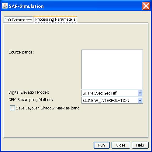
Parameters Used
The following parameters are used by the operator:
- Source Band: All bands (real or virtual) of the source product.
User can select one or more bands for producing simulated image. If
no bands are selected, then by default all bands are selected. The
selected band will be output as a band in the target product
together with the simulated image.
- Digital Elevation Model: DEM types. Choose from the
automatically tiled DEMs or specify using a single external DEM
file by selecting "External DEM".
- DEM Resampling Method: Interpolation method for obtaining
elevation values from the original DEM file. The following
interpolation methods are available: nearest neighbour, bilinear,
cubic convolution, binsinc and bicubic interpolations.
- External DEM: User specified external DEM file. Currently only
WGS84-latlong DEM in meters is accepted as geographic
system.
- Save Layover-Shadow Mask as band: Checkbox indicating that
layover-shadow mask is saved as a band in the target product.
Detailed Simulation Algorithm
Detailed procedure is as the follows:
- Get data for the following parameters from the metadata of the
SAR image product:
-
- radar wave length
- range spacing
- first_line_time
- line_time_interval
- slant range to 1st pixel
- orbit state vectors
- slant range to ground range conversion coefficients
- Compute satellite position and velocity for each azimuth time
by interpolating the orbit state vectors;
- Repeat the following steps for each cell in the DEM image:
-
- Get latitude, longitude and elevation for the cell;
- Convert (latitude, longitude, elevation) to Cartesian
coordinate P(X, Y, Z);
- Compute zero Doppler time t for point P(x, y, z) using Doppler
frequency function;
- Compute SAR sensor position S(X, Y, Z) at time t;
- Compute slant range r = |S - P|;
- Compute bias-corrected zero Doppler time tc = t + r*2/c, where
c is the light speed;
- Update satellite position S(tc) and slant range r(tc) = |S(tc)
– P| for the bias-corrected zero Doppler time tc;
- Compute azimuth index Ia in the source image using zero Doppler
time tc;
- Compute range index Ir in the source image using slant range
r(tc);
- Compute local incidence angle;
- Compute backscattered power and save it as value for pixel
((int)Ia, (int)Ir);
Reference:
[1] Liu H., Zhao Z., Lezek K. C., Correction of Positional
Errors and Geometric Distortions in Topographic Maps and DEMs Using
a Rigorous SAR Simulation Technique, Photogrammetric Engineering
& Remote Sensing, Vol. 70, No. 9, Sep. 2004
[2] Gunter Schreier, SAR
geocoding: data and systems, Wichmann-Verlag, Karlsruhe,
Germany, 1993