

|
EOMasters Toolbox Basic | |
These extensions provide new functionalities for the Band Maths expressions. The following functionalities are available:
<band-name>.valid
e.g., -->
Oa10_radiance.validX,Y) and the
geographic coordinates (LAT,LON) in a Band Maths
Expression. With these two new symbols (MAPX, MAPY)
you can also access the map coordinates of the product scene. The
returned coordinate represents the center of the pixel. If the
scene is not reprojected to a map, the geographic coordinates are
returned. The X and Y map coordinates are returned by the symbols:
MAPX and MAPYareValid(<band_name>, <band_name>,
...) e.g., -->
areValid(B2, B3, B4, B8)<func>(<value>, <value>,
...)minOf(0.7, <B7>, <B8>,
<B8A>)maxOf(<B1>, <B2>,
0.2)meanOf(<B1>, <B2>, <B3>,
<B4>, <B5>)<func>(<value>, <value>,
...)indexOfMin(0.7, <B7>, <B8>,
<B1>)indexOfMax(<B1>, <B2>,
0.2)wnd(<band_name>, <window_size>,
"<function>") The following functions are
available:wnd(B8A, 3, "sum")wnd(B2, 3, "min")wnd(B2, 7, "max")wnd(B2, 7, "mean")wnd(B3, 5, "median")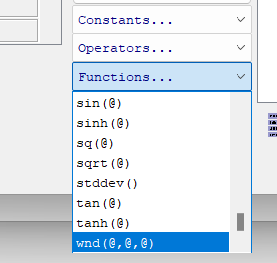
true all samples of the raster are considered. If
statistics have already been computed, then these are used and not
recomputed. Except, these have a low accuracy and accurate results
are requested.stx(<band_name>,
"<property>", accurate)stx(B2, "min")stx(B2, "max", true)stx(B2, "mean",
false)stx(B3, "median")stx(B3, "sigma",
true)stx(B3, "rsd",
false)stx(B3, "enl")