
| Export CSV Data | |
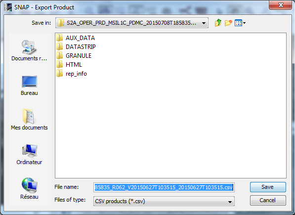
The Sentinel Toolbox supports the export of raster data as CSV
('Comma-Separated Value') plain text files. To invoke this export,
choose the item 'Export Raster Data' --> 'CSV' from the 'File'
menu. A file chooser dialog will be displayed to select an export
file (extension .csv). By default, all bands, tie point grids and
metadata sets will be exported to the CSV file (row by row from top
to bottom of the product raster, each row from left to right. Each
pixel is represented by one line in the CSV file, each quantity by
one column. An additional column with the 'featureId' (which is
just an ascending pixel counter) is put in front. Also, the file
contains a header line with the names and data types for each
column (name and data type separated by ':'). The column separator
is the 'tab' character. See example below.
Two additional header metadata fields are stored with the CSV file
to facilitate reconstruction of the CSV data to a full operational
SNAP product:
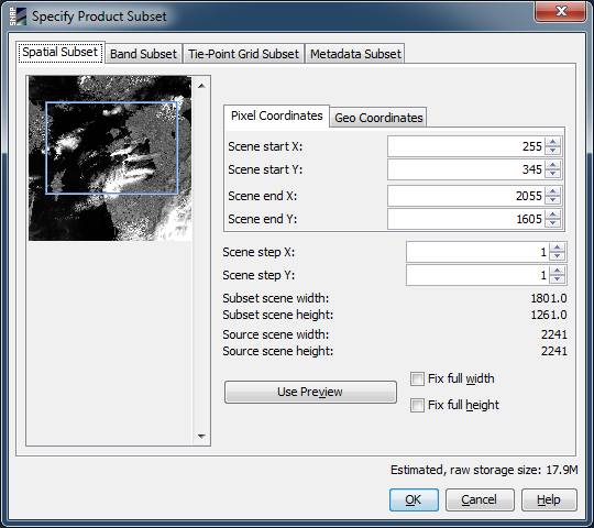
CSV exports of a whole product would usually become very large. Therefore, the export functionality offers the opportunity to define subsets: either spatial subsets, or subsets by choosing only distinct bands, tie point grids or metadata items. To define the subset to be exported, click the 'Subset...'-button in the upper right of the export file chooser dialog. The Specify Product Subset dialog will be opened for subset specification.
       featureId    radiance_8:float    radiance_10:float   l1_flags:byte   latitude:float  longitude:float sun_zenith:float    zonal_wind:float
       0            13.244587           9.0632085           2               58.19586        11.328176       39.820213           3.1320314
       1            13.244587           9.0632085           0               58.194206       11.345581       39.813232           3.0703127
       2            15.124778           11.723249           0               58.192554       11.362987       39.806255           3.0085946
       3            21.126123           23.472494           2               58.190978       11.380392       39.799282           2.9468756
       4            21.126123           23.472494           8               58.189247       11.397799       39.792366           2.8851564