Ellipsoid Correction RD Operator
The operator implements the Range Doppler
orthorectification method [1]. The implementation is exactly the
same as for the Range
Doppler Terrain Correction operator except that the averaged
scene height is used instead of DEM.
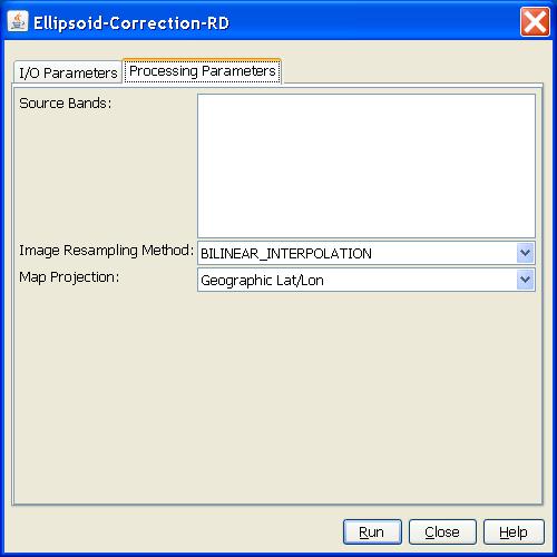
Parameters Used
The following parameters are used by the operator:
- Source Band: All bands (real or virtual) of the source product.
User can select one or more bands. For complex product, i and q
bands must be selected together. If no bands are selected, then by
default all bands are selected.
- Image resampling method: Interpolation methods for obtaining
pixel values from source image.
- Map Projection: The map projection types. The orthorectified
image will be presented with the user selected map
projection.
[1] Small D., Schubert A., Guide to ASAR
Geocoding, Issue 1.0, 19.03.2008